Opening the Black Box of 3D Reconstruction Error Analysis with VECTOR

Racquel Fygenson

Zongzhan Li
Francois Ayoub
Robert G Deen


Mauricio Hess-Flores
Published at
VIS
| St. Pete Beach, Florida
2024
Abstract
Reconstruction of 3D scenes from 2D images is a technical challenge that impacts
domains from Earth and planetary sciences and space exploration to augmented and
virtual reality. Typically, reconstruction algorithms first identify common
features across images and then minimize reconstruction errors after estimating
the shape of the terrain. This bundle adjustment (BA) step optimizes around a
single, simplifying scalar value that obfuscates many possible causes of
reconstruction errors (e.g., initial estimate of the position and orientation of
the camera, lighting conditions, ease of feature detection in the terrain).
Reconstruction errors can lead to inaccurate scientific inferences or endanger a
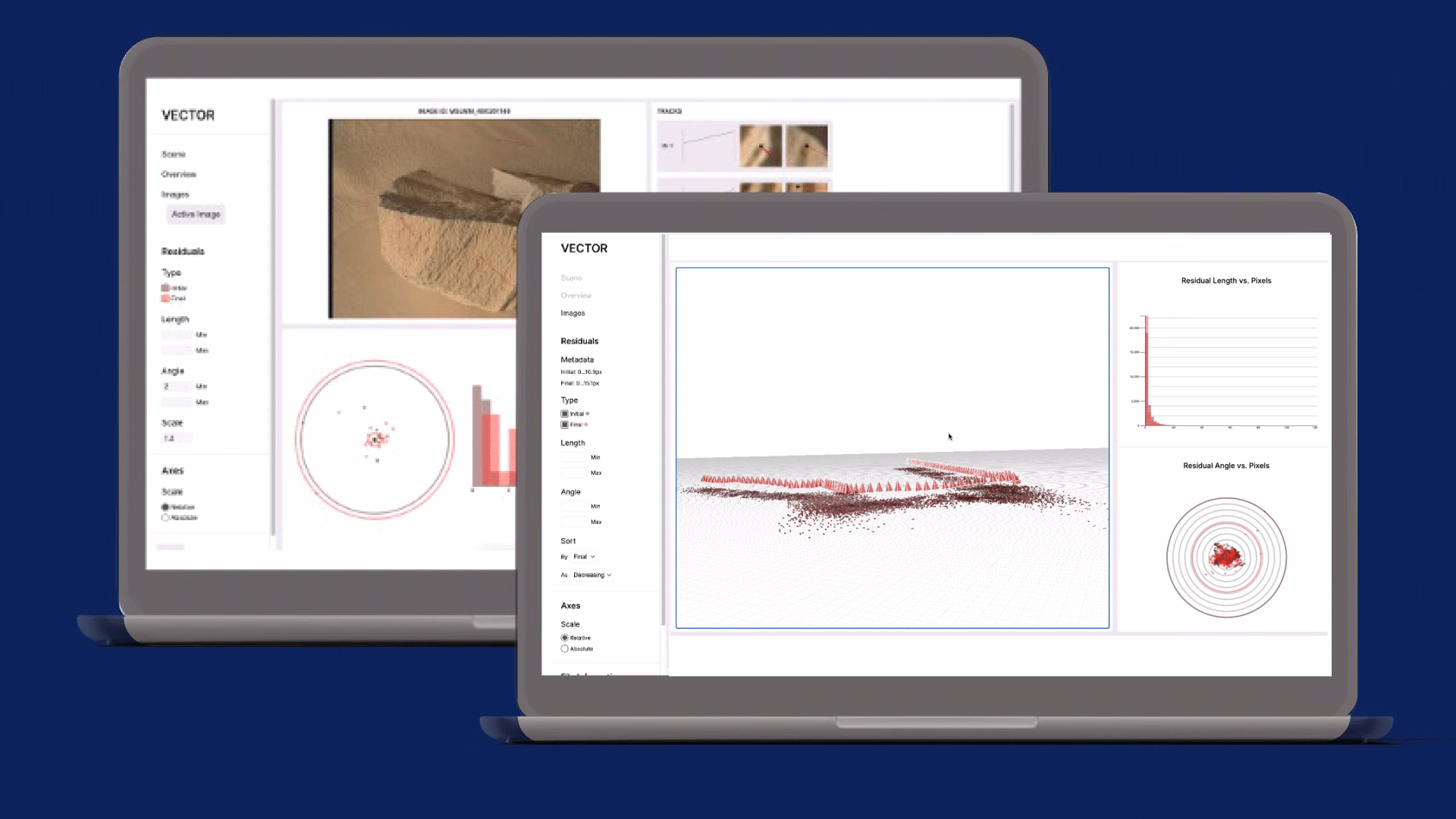
spacecraft exploring a remote environment. To address this challenge, we present
VECTOR, a visual analysis tool that improves error inspection for stereo
reconstruction BA. VECTOR provides analysts with previously unavailable
visibility into feature locations, camera pose, and computed 3D points. VECTOR
was developed in partnership with the Perseverance Mars Rover and Ingenuity Mars
Helicopter terrain reconstruction team at the NASA Jet Propulsion Laboratory. We
report on how this tool was used to debug and improve terrain reconstruction for
the Mars 2020 mission.